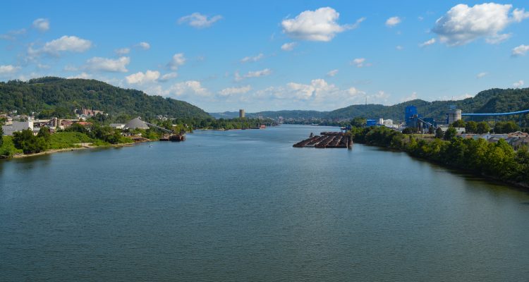
Devastation.
That’s what Lou Vargo with the Ohio County Emergency Management Agency thought would take place. He admits he envisioned a disaster comparable to the damage that occurred in mid-September 2004, when all creeks in the Upper Valley flooded and when the Ohio River crested more than nine feet over its banks.
Vargo prepped for conversations with the Red Cross, with FEMA and with the West Virginia National Guard because, based on the forecast issued by the National Weather Service, he was confident this river region would suffer from back-to-back flooded weekends, and the second one was going to be far worse.
“Based on everything we were told, we were bracing for the worst,” the 27-year EMA veteran said. “The river was already up, and the creeks rose quickly. If we would have experienced the amount of rain that was predicted, everyone would have been, flooded.
“The National Guard did travel to locations here and in Morgantown, so they were in place when the flooding began, but both storms, somehow, missed us, and they missed the areas in western Pennsylvania, too, that impact our creeks and the Ohio River,” he continued. “It missed us, thank God.”
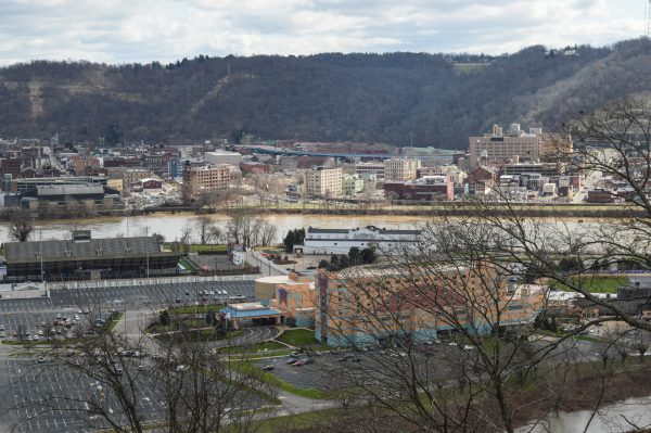
Fred McMullen with the National Weather Service in Pittsburgh remains in regular contact with Vargo and other EMA directors in the tri-state region, and he explained this time the news he delivered was not favorable.
“We most definitely dodged a bullet,” said McMullen. “We had a situation where we had four inches of rain in three days in the forecast for the Wheeling area, and we were very concerned. But, when we only had a little over two inches of rain that did fall, we were happy because that meant there wasn’t as big of impact on property.
“We were expecting the precipitation to come in several rounds, and we did get a lot of rain on one of those three days,” he continued. “And then we saw another round coming the next day, but for the most part that missed this region and traveled to the north. The heaviest rain in the forecast was for last Saturday night into Sunday (Feb. 24-25), and we did get some significant rainfall, but not what was in the forecast, thank goodness.”
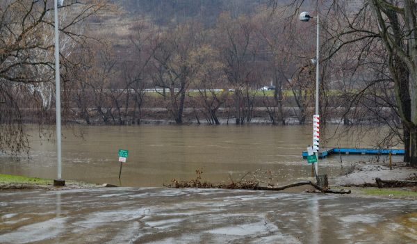
The Island
For them, IT comes up slowly at first and then rushes very quickly as IT streaks a path into basements and first floors.
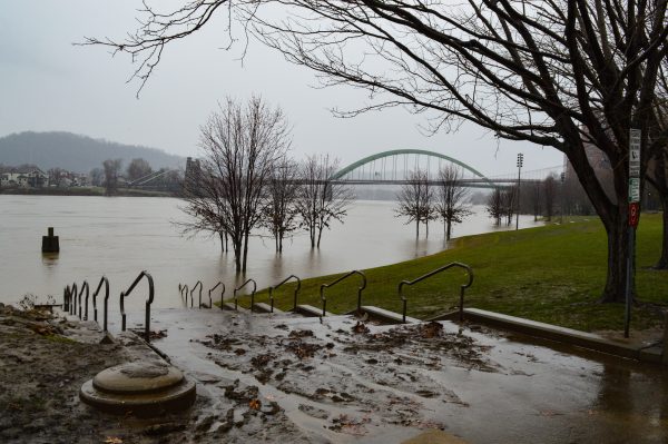
IT, of course, is the Ohio River, a waterway that many Wheeling Island residents know all too well. Late in February, a crest of above 39 feet caused the closure of Wheeling Island Hotel-Casino-Racetrack for two days and resulted in families and apartment tenants clearing basements. Most of them knew, though, not to return anything to that bottom level just yet.
“We live on an island, and we know that,” said Lynne Walton, a resident of Wheeling Island since the early 1990s. “Floods are a part of living here. Now, we really like it when there aren’t floods to worry about, but we know what to do.
“The longtime residents all know their numbers, as far as the crest level,” she continued. “But if it reaches into the 40s, then almost everyone on Wheeling Island will have to deal with the water.”
The National Weather Service released a crest-level prediction for the Ohio River at Wheeling above 40 feet. According to the graphs published by the Ohio County Emergency Management Agency, high water impacts the southern tip of Wheeling Island first, and then as the levels increase, so does the number of affected properties.
Worst-case scenario, according to McMullen, included a river crest above 43 feet.
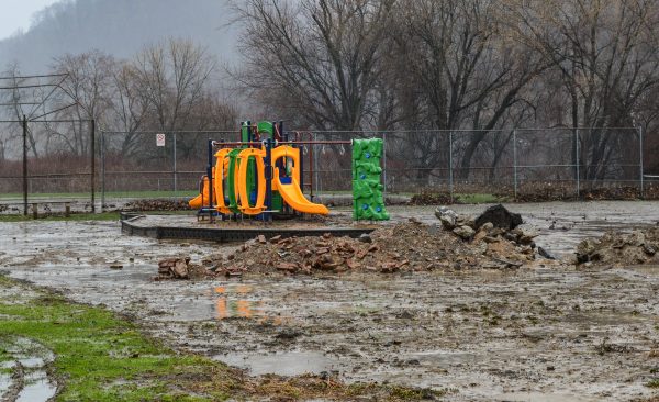
“That’s why we were talking with Lou six or seven days before this system made its way to this area because of what we saw in the models, and that’s because we wanted everyone to know what was possible as early as we could,” McMullen said. “It was really like a roller coaster at Kennywood because the threat would increase, and then it would decrease.
“Our office received a lot of calls from the Wheeling area, and that was because of the impacts to the residents on Wheeling Island and along the creeks and streams,” he said. “They just wanted people to be as prepared as possible, and I believe they were.”
Wheeling Island resident Tom Boyd has endured several floods during the last four decades, so he knows the steps to take to avoid as much property damage as possible.
“Been going through this stuff for a long time; I’ll tell you that,” he said. “It gets a little crazy waiting for the weather folks to give updates on what the crest is going to be. This last time, the highest was 41.5, and I know that gets me.
“We all know, though, that it can change up and down pretty quick, and thankfully it did. We just want to know what to expect and if it’s getting to the first floor,” Boyd explained. “We’re all used to our basements getting water, and most of us don’t really have much down there, but the first floor? Most of us haven’t seen that since 2004.”
Past, Present, Future
The NOAA (National Oceanic and Atmospheric Administration) website also features data on historical crests at the northern tip of Wheeling Island, and it reveals that more than 40 floods have impacted the community since 1901 and that the only decade during which they savored salvation was during the 1980s.
The highest recorded level was 55.20 feet on March 19, 1936, and prior to that event, the river was measured at 51.2 on March 28, 1913, and at 51.5 feet on New Year’s Eve 1942. Nearly two weeks ago, though, the basements and boathouses at more than 100 homes, as well as parts of Wheeling Island Hotel-Casino-Racetrack and the surface of Wheeling Island Stadium, were all soaked after 13 years without a significant flood.
In 2005, two floods hit back-to-back, first on Jan. 7, 2005, at 42.17 feet, and then the river reached back to 34.60 six days later, a level that affects live greyhound racing and parking lots at the casino. The highest crest since the turn of the century took place on Sept. 19, 2004, after flash flooding devastated the Edgwood, Pleasanton, and Dimmeydale neighborhoods in Wheeling and many others in the Upper Ohio Valley.
The remnants of Hurricane Ivan, a storm system that made landfall in Florida and Alabama and caused more than $20 million in damages in the United States, settled over the Upper Ohio Valley region and dumped as much as 10 inches of rain in 10 hours. At 45.30 feet, it was the worst measured flood on Wheeling Island since Jan. 20, 1996, when the waterway reached 45.40. That time, though, Big Wheeling Creek remained within her banks. In 2004, however, flash flooding occurred along most of the area’s creeks and streams and two days before the river crested.
“I wasn’t planning on last week (late February) being a good day around here because of how bad the flooding was supposed to be. It looked a lot like it did in 2004,” Vargo admitted. “As it turned out, the creeks stayed pretty steady after coming up a bit, and the river level rose, but it stayed within its banks, too.
“Usually, flooding takes place on the creeks, and then the river floods, but my biggest concern (in late February) was that it was all going to take place at the same time,” he said. “If that was the case, the water in the creeks would not have had a place to empty, and that would have made the situation far worse than what we are used to in the Upper Ohio Valley.”

If temperatures had dipped into the low 30s and the rain had been snow, McMullen explained, the tri-state area would have been blanketed with snow comparable to what fell on March 13, 1993.
“Typically, about an inch of rain equates to 12 inches of the snow,” the meteorologist explained. “If the rainfall that we did receive in the Wheeling area would have been snow, we would have seen between 24 and 30 inches of snow. But, when it’s raining in February and March, it’s usually a good thing because of the alternative.
“The Wheeling area did see a record rainfall in the month of February because it rained about 6.5 inches, and that was the most since the 1940s,” he reported. “The previous record, though, was set back in 1878 when Wheeling received 5.37 inches, and last week we had three consecutive days of dry weather for the first time since Jan. 19-21.”
As far as the long-range forecast for the upcoming spring and summer seasons is concerned, McMullen predicted above-average temperatures and normal levels of precipitation.
“Right now it appears that during the rest of the month of March we could see some pretty big swings in the temperatures. That doesn’t mean it could be in the 50s one day and in the teens the next, but it does mean that we could see the 50s one day and the 30s the next,” he explained. “March, historically, is the area’s highest snowfall month in terms of seeing the most storms, and I am sure there are plenty of residents there who can recall some of the biggest snowfalls.
“As far as the summer, right now we are seeing temperatures slightly above normal and, at that time of year, the average temperature is around 84 degrees. We don’t believe it will be super-hot but a little warmer than normal,” McMullen added. “Last summer was below normal because, typically, the Wheeling area experienced about 12 days when the temperatures are in the 90s, but there was not a single day in 2017 above that mark, so we’ll have to see what 2018 brings us.”
(Photos by Steve Novotney)


