

Earl’s note: This is the second of a short series about things to do with kids. The activities described in the series are inexpensive and fun outdoor things that anyone can do with children. The next story in the series will be about tent camping complete with hobo pies, sleeping bags and no internet. Welcome to Earl’s Capers With Kids, Part II.
Are you looking for a fun outdoor activity to do with your children or grandchildren? How about an adventurous game of high-tech hide and seek? Take the kids geocaching.Geocaching is a worldwide adventure game in which participants hide small containers of goodies and then post the latitude and longitude coordinates online challenging other geocache gamers to find them using their GPS devices.
Global Positioning System (GPS) devices like smartphones, automotive navigational systems and handheld GPS receivers communicate with an array of specialized satellites to establish their precise latitude and longitude position using a simple process called trilateration. The global positioning system receiver in the device determines its distance from the satellites using a very precise timing system. If the receiver can communicate with three or more GPS satellites, it can use those distances to determine its exact latitude and longitude anywhere on the planet.
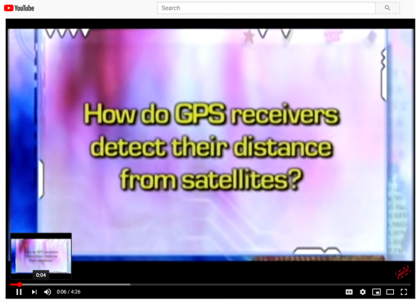
GPS devices are accurate to within a few feet. Click here for a kid-friendly video describing how the Global Positioning System works.
If you want to learn more about GPS, then visit the U.S. Government GPS site. The U.S. Air Force operates the Global Positioning System satellites. Prior to 2000, the Air Force injected an intentional error, called selective availability, into the system to make it more difficult for an enemy to use the system to target American interests. That error was removed on May 1, 2000, making consumer GPS devices accurate to within a few feet.
On May 3, 2000, Dave Ulmer of Beavercreek, Oregon, hid a partially buried plastic bucket and posted the precise latitude and longitude coordinates (GPS coordinates) online. Within a few days, the hidden bucket had been found several times, and other people began hiding containers and posting the coordinates.
Since that time, the geocaching game has exploded into an international phenomenon with thousands of geocaches hidden around the world. Geocaching enthusiasts created the website, www.geocaching.com to share information about the hidden caches including the exact latitude and longitude (GPS) coordinates for the caches.
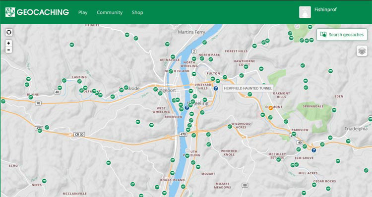
The free geocaching.com membership provides access to a wealth of information about the geocaches, including background information, information about the size of the caches and information about the difficulty of finding the caches. Most geocache pages on the site also include a hint. The cover picture at the top of this story consists of a screen capture of the map from the geocaching.com website showing geocaches that are hidden near Wheeling. Geocachers who have found the caches may report their finds and make comments about the geocaches on the website. When you join the site, you will need to create a user name. Mine is Fishinprof.
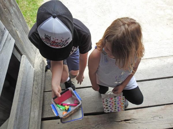
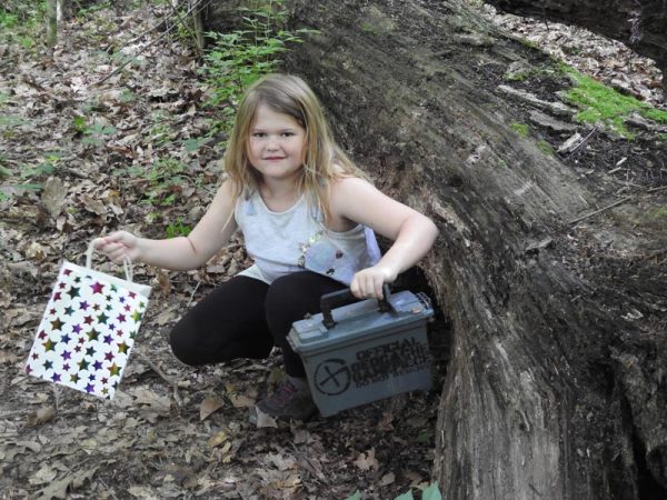
Geocaches vary in regard to size, contents and difficulty. However, a typical geocache consists of an ammo can, Lock-N-Lock box, or other watertight container with a logbook and pencil, and a variety of trade items inside. When you find a geocache, you can remove one of the trade items and replace it with something that you brought as a trade item. Inexpensive but fun trinkets make great trade items. Do not use food items such as candy or gum as trade items. Geocaching rules also prohibit putting promotional items into a geocache. Kids love the trade items, and part of the fun is having them figure out what they want to use as trade items, but trade items are not required. However, children need to know that they cannot remove a trade item unless they put one in. Some geocaches contain travel bugs or other trackable items.
Each trackable has a page on the geocaching.com site. If you find a geocache containing a trackable, you may opt to remove the trackable and then to place it into another geocache later. When you remove a trackable, you log onto the page for the trackable and make a note of when you removed it from the geocache. When you place it into another geocache later, you go back onto the page for the trackable and enter the name of the geocache where you put it. That way, the owner of the trackable and the rest of us can have the fun of watching how far and wide it travels.

Today, every cellphone has a built-in GPS receiver. If you have a smartphone, you can download the geocaching app, which works great. When you open the app, it immediately loads the nearest geocaches and displays their locations on a map. You can also copy and paste or enter a geocache ID number from the website into the app, thereby adding that geocache to the list on the app even if it is not nearby.
When you tap on one of the geocaches on the list, the app loads information about the geocache. To search for the geocache, just tap the button. The app displays a line on a map showing the direction. It also displays the distance to the geocache. The compass on the geocaching app also points to the geocache and gives the distance. You need to have a cellphone signal to load the information about the geocache, but not to use the GPS on the phone to find it. I have a small handheld GPS unit of the type used by hikers, hunters and fishermen. It came with a geocaching app already installed.
Using a USB cable to connect the device to my laptop allows me to download information about a geocache directly from the geocaching.com site into the GPS unit. When I open the geocaching app and tap on that geocache, the app displays a map showing a line leading to the location of that geocache. In addition, the compass on the GPS displays a red arrow pointing toward the geocache. The compass screen also displays the distance to the cache.
We recently took our grandchildren geocaching at Slate Run Metro Park in central Ohio. They used the phone app and the GPS app to locate all four geocaches in the park. Our youngest granddaughter brought four small polished stones to use as trade items. She was easily able to find one of the geocaches using my handheld GPS unit. Our grandson led the way to the other three using the geocaching app on a cellphone.
When you hand a small child the phone or GPS unit and let them lead the way to the geocache, there are a few things you need to remember. The first is that the device is going to point directly toward the location of the geocache. Most of the time, various obstacles block the direct route to the geocache. Do not allow the children to head off through the woods toward the geocache. If you are in a park, look at the trail map and follow the trails to the closest point from the geocache. Geocachers call going through the thick brush and undergrowth of the woods “bushwhacking.” Very few geocaches require much bushwhacking which is dangerous and can be damaging to the forest. Usually, geocaches hidden in a forested area are only a few feet from the trail.
You also need to remember that the GPS device will only get you to within a few feet of the hiding place. If obstacles such as overhead trees obscure the satellite signals, the location shown on your GPS could be off by 15 feet or so.
Also, remember that the coordinates recorded by the owner of the geocache were from wherever he or she was standing after hiding the cache, so they might be 15 or 20 feet away from the actual cache location. When your GPS receiver indicates that you have arrived at the location of the hidden cache, start looking for anything out of the ordinary.
Geocaches are never buried, so you don’t need a shovel. Look for hollow trees or hollow logs. Look under big logs or piles of brush or sticks or stones. Look in the crotches and hollow places in the trees, but you should not need to climb any tree to get to the geocache. Leave no stone unturned. Sometimes the geocache is under the stone. When you look up the geocache on the website, make a mental note of the size so you know how large of hiding place to find. One geocache near West Liberty consists of a black plastic film container hidden under a small rock leaning against a guardrail post.
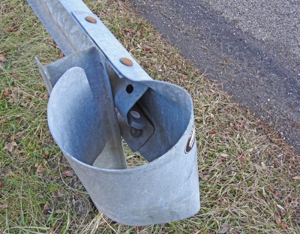
Look for anything metal where a magnetic geocache might be stuck. Geocache hiders love those little magnetic key holders. If you are near a guardrail, look in the cavities created where the guardrail bolts to the posts. If you were led to a bridge, look in the bridge structure. Remember that nothing needs to be damaged, disassembled or dug up to get to the geocache. If you get stumped, look at the notes about the cache on geocaching.com. Sometimes, there is a hint, and those notes on the website left by other geocache enthusiasts may help you find it. Slowly expand your search area to a radius of about 20 feet. Be sure to take a pencil with you to sign the log in case the one in the geocache is missing.
Play safely. In addition to not allowing children to randomly head off into the woods, you need to remember that those woods might be infested with mosquitoes and ticks, so be sure to apply insect repellant. If your adventures will take you into sunny areas, remember to use sunscreen.
Geocache hiders love to put their treasures into hollow logs or in cavities under piles of brush or under tree roots or inside or under metal pipes. Wild animals also love those places. Before you allow a child to reach into a hollow log, you need to stand a safe distance away and look into the cavity to make sure that it does not contain an angry raccoon or skunk.
Watch out for poison ivy. Leaves of three — let it be! Have the kids wear long pants if you are going into the woods. When you get home, do a tick check on the children and on yourself. Look carefully because the deer ticks that carry Lyme Disease are very small. Sometimes, they are less than half of the diameter of a BB. A few hours later, do a second tick check. If you are just getting started or are geocaching with very young children, look for the geocaches that do not require much walking.
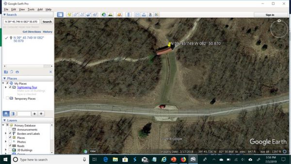
I like to cheat a little using Google Earth on my laptop. I log onto geocaching.com and search for geocaches that are located in the area that we are planning to visit with the grandkids. Then, I click on the geocache and drag over the latitude and longitude coordinates. By hitting control-C, I copy those coordinates onto the clipboard. Then, I open Google Earth and paste those into the search box. Google Earth places a pin at the location allowing me to zoom in and see about where the geocache is located. I am able to tell if it will require a long hike. If it is in a park, Google Earth allows me to see the hiking trails. Usually, I just take a cellphone picture of the screen. Sometimes, I make a screen print and email it to myself. If it is going to require a 3-mile hike, I usually pass on it because that is a 6-mile round trip, which is fine for older folks, but not for young children.
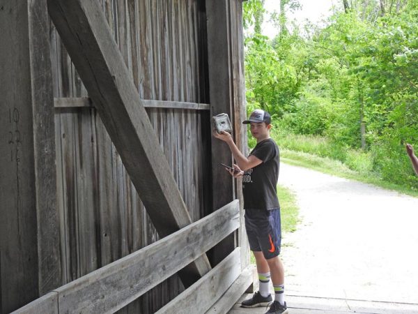
Sometimes, Google Earth provides a surprising amount of detail of the area. One of the Slate Run geocaches was hidden in the covered bridge. Google Earth actually showed me which end of the bridge contained the cache. I saw it immediately when I entered the bridge, but my grandkids searched for several minutes before they found it.
Most of the time, getting to the locations where geocaches are hidden requires a trip in the car. We use our automotive GPS to navigate to the general location where the geocache is hidden because the outdoorsman GPS does not navigate by road. Our automotive GPS has a screen that permits me to enter the latitude and longitude coordinates. The Maps app on my smartphone does not have a similar screen, so I use Google Earth to find an address or landmark and then put that into the phone if I want to use the phone to navigate. The Google Earth satellite pictures also show nearby parking areas.
Muggles are everywhere, so keep an eye out for them. You do not want to lead the Muggles to the geocache because they might destroy it or remove it. If you are a Harry Potter fan, you will know that a Muggle is an ordinary human being who has no superpower. In geocaching terms, a Muggle is someone who does not know about geocaching. Since they do not know about the game, they often remove a geocache and take it home with them if they happen to find one even though geocaches are all clearly marked as geocaching game pieces.
The last thing to remember is to leave no trace. If you carry anything in, carry it out. If you see litter left by someone else, pick it up. Make sure that you do not disturb things around the geocache or the path leading to it so that your efforts won’t give away the location. Put the geocache back where you found it unless it is clearly out of place. One of the Slate Run geocaches was out in the open when it was supposed to be under a big fallen log. We put it back where the hint said it should have been. Go onto the geocaching.com site and log your finds and be sure to note any problems with the caches. Two of the Slate Run geocaches were in plastic replica ammo cans that had leaked, making the contents wet. We reported those problems when we logged the finds on geocaching.com to inform the owners that those two geocaches needed maintenance.
To close this story, I am going to don my teacher educator hat. As teachers, we know that the best thing that parents can do to help their children to succeed is to spend quality time with them by doing things together. When you hand your child or grandchild a GPS device and let them lead the way to a geocache, you empower them. Sometimes, you may need to provide some guidance for them, but let them find the geocache even if you know where it is located so that they have the pride of success. Even if the geocache is not found, the quality time that you spend with your children or grandchildren is the real reward.